HAVING A VARIETY OF USABLE TRAILS is essential for experiencing the solitude that Aldo Leopold enjoyed, says Melissa Green, trails project coordinator of Gila Back Country Horsemen. “Keeping people going to different places is big so the wilderness stays pristine.” The nonprofit trail-maintenance group’s website shares accurate maps and route descriptions. “We try to highlight trails that we know either ourselves or the Forest Service have worked on,” she says. While some may opt to backpack the 100-mile Gila Wilderness Centennial Loop in celebration of the anniversary, others can choose from Green’s day-hike recommendations.
Loop Near the Cliff Dwellings. This varied 4.2-mile loop climbs only 355 feet and offers views of both the Gila and Aldo Leopold wildernesses. After walking grassy mesas and dipping in and out of canyons, hikers turn onto West Fork Trail #151, which leads downstream past Gila Cliff Dwellings National Monument to Woody’s Corral, finishing with a short stretch of road north to TJ Corral. Note: This loop can only be completed when the West Fork is not flooding.
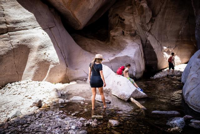
There's plenty of trails to explore in the vast Gila.
Gold Dust Trail #41. Just off the road to the ghost town of Mogollon, this 2.1-mile out-and-back trail leads to Whitewater Creek and can be tied in with the Catwalk Trail. “People could keep going or just turn around where it junctions with Whitewater Trail,” says Green, who advises against this route in the hot summer months. “It offers really great views.”
Rain Creek Trail #189. Hike out and back on this 8.6-mile trail into the Gila Wilderness from Sacaton Road. The trail winds from grassy rangeland to piñon-juniper forest to creek bottom, paying off with views of the Mogollon Mountains. Bring your trekking poles to navigate the rocky first mile down to Rain Creek and the steep climb up the canyon’s other side. At the junction of the Rain Creek Divide Trail, take the path to the right, which connects with the recently improved West Fork Mogollon Trail #224.
Snow Lake makes a great base.
Snow Lake Trail #142. Experience the headwaters of the Gila River with a one-mile high-alpine hike from Dipping Vat Campground, where Snow Lake Trail brings hikers across the dam and down the canyon to Gilita Creek. “Snow Lake Trail junctions with the Middle Fork #157 really quickly, so people can decide if they want to keep going,” Green says.